AI vs. COVID-19
forecasting crowded locations
This project seeks to develop predictive models to help minimize a person’s potential exposure to infection, as they practice social distancing but while also making essential trips for food, medicine, and helping others that need help.
- https://chronorobotics.tk/cs/ai-vs-covid — description of the project
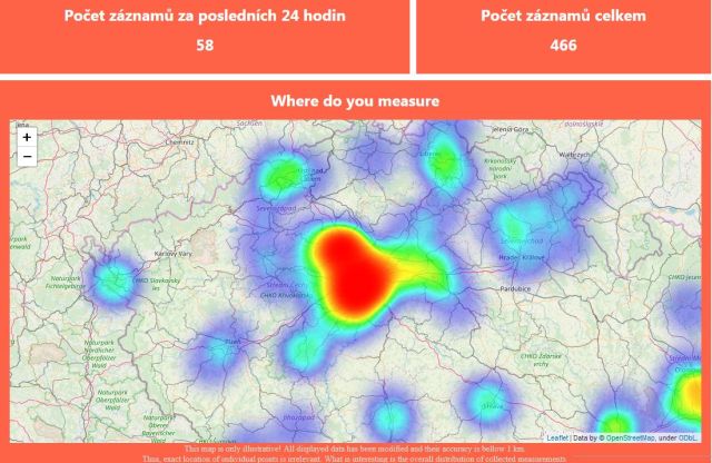
- https://app.chronorobotics.tk/ — current coverage map
Recommendations of essential trip times by forecasting crowded locations
Prevention is the key
Problem: Social distancing vs. essential trips for food, medicine and work.
Proposed solution: Use spatio-temporal models developed in the robotics
domain to forecast people density at exposed locations.
Data collection: Community driven reports of people density
(app - already developed and in testing).
Data are about locations, not people, fully anonymous from the start.
Data processing: Based on the Frequency map Enhancement concept
(www.fremen.uk), which normally can predict days
ahead. Codes are available, method was tested in a 2 year experiment, but not
on a country-wide scale. However, method is scalable for distributed
computation.
End user: App with recommendations of time and risk assessment for the next
day.
Impact: While short term impact is hard to evaluate and predict, the app
should be useful for social distancing in general even in the eventual
post-Covid era. It will be a handy tool for regular flu epidemies that appear
on a regular basis. The patterns of collective behaviours are of a potential
interest to the scientific community.
However, similarly to the HIV, COVID-19 might pose a persistent threat, so that
we will have to alter our behaviours persistently. Since the app is already
tested abroad and is simple, it has a certain potential to become a commonly
used tool for „Hygiene 4.0”.
RISKS and mitigation:
Government intervention: Governmental policy to separate population groups.
Local governments might impose strict outdoor presence schedules, e.g., you can
shop only twice per day at times that are equal to the last three digits of
your credit card or ID. Mitigation: Focusing on public spaces, like parks,
playgrounds etc.
Rejection due to ethical considerations: While in Czechia, the government
pushes towards tracking systems, and our system provides an alternative, other
countries are reserved. For example, there is an ongoing discussion in
Switzerland, if estimating densities in public spaces is a justifiable measure.
Mitigation: Emphasize the fact that the data are anonymous from the start,
the tool is advisory and is based on concepts of personal responsibility rather
than top-down interventions.
System failures: Potential software bugs could cause wrong predictions,
loss or closure of data. Prevention: Public testing, open sourcing, respecting
„anonymity over system performance”. Usage of ethic guidelines common in
research.
Mitigation: Enough manpower to maintain the system.
Not enough data: People will not use the data collection app and
therefore, there will be no models. Prevention and mitigation: Explain that
that one can act locally - persuade 10 of your neighbours and you have the
models of the shops and parks you attend in 2 days.
